Seminar-training, 17-18 May 2018, Kyiv
SEMINAR-TRAINING
GEODETIC INFORMATION SYSTEM 6
17-18 may 2018
venue of Kyiv, st. Lomonosova, 18, rm. 101
(Kyiv Cooperative Institute of Business and Law)

 17-18 may 2018
the representatives of 8 areas: Odessa, Mykolayiv, Zaporozhye,
Kharkov, Kiev, Zhytomyr, Chernihiv,Dnipropetrovsk
gathered for a two-day seminar-training
"Geodetic Information System 6", which was dedicated
the formation of the exchange file of land cadastre information in the format
XML, in accordance with the Order №1115 of 23.12.2015,
Order of the State Committee№ 1051 of 17.10.2012 and requirements of the National
cadastral system (NCS) the formation of the exchange file data XML,
import and calculation theodolite traverses and pickets, creating land areas, limitations and easements, transformation of coordinate systems
at USK-2000 and MSK-2000, connection to Public cadastral map
Of Ukraine and Google Maps. This is the tenth seminar for project organizations, which conducts ShelS Company. The main feature
these activities are an opportunity to practice skills in practice
to work in the GIS program 6, to receive answers to the
questions and share experiences with colleagues. On the first day participants
acquainted with the capabilities of the program GIS 6; general information on
windows "Land plots" and "Cameral functions"; creation of land plots; completing the data subjects rights, restrictions, easements, leases; general information about the exchange file format XML; import and export exchange files XML; setting and checking of export exchange files XML. The second day was dedicated treatment measurements in the "Calculation and adjustment theodolite traverses and pickets";
creation of subcontractors, easements; translation of coordinates from SK-63 to USK-2000
or MSC-2000 and vice versa; work with layers; familiarization with the basics
mapping module "MapDraw 2". According to the results of the training seminar, each participant received a nominal Certificate.
17-18 may 2018
the representatives of 8 areas: Odessa, Mykolayiv, Zaporozhye,
Kharkov, Kiev, Zhytomyr, Chernihiv,Dnipropetrovsk
gathered for a two-day seminar-training
"Geodetic Information System 6", which was dedicated
the formation of the exchange file of land cadastre information in the format
XML, in accordance with the Order №1115 of 23.12.2015,
Order of the State Committee№ 1051 of 17.10.2012 and requirements of the National
cadastral system (NCS) the formation of the exchange file data XML,
import and calculation theodolite traverses and pickets, creating land areas, limitations and easements, transformation of coordinate systems
at USK-2000 and MSK-2000, connection to Public cadastral map
Of Ukraine and Google Maps. This is the tenth seminar for project organizations, which conducts ShelS Company. The main feature
these activities are an opportunity to practice skills in practice
to work in the GIS program 6, to receive answers to the
questions and share experiences with colleagues. On the first day participants
acquainted with the capabilities of the program GIS 6; general information on
windows "Land plots" and "Cameral functions"; creation of land plots; completing the data subjects rights, restrictions, easements, leases; general information about the exchange file format XML; import and export exchange files XML; setting and checking of export exchange files XML. The second day was dedicated treatment measurements in the "Calculation and adjustment theodolite traverses and pickets";
creation of subcontractors, easements; translation of coordinates from SK-63 to USK-2000
or MSC-2000 and vice versa; work with layers; familiarization with the basics
mapping module "MapDraw 2". According to the results of the training seminar, each participant received a nominal Certificate.
|
ORGANIZATIONAL MATTERS |
||
| Date
of:
17-18 may 2018
Event venue: Ukraine, Kyiv, st. Lomonosova, 18, rm. 101 (Kyiv Cooperative Institute of Business and Law) Terms of: classes focus on hands-on learning work program GIS 6, therefore work more efficiently participants, it is desirable to take seminar-training notebook The cost of participation: If you pay from May 01 to May 11, one day of participation - 900 UAH for 1 person; two days of participation - 1700 UAH for 1 person. The price includes: participation in training seminar, training materials, CD with training materials and Certificate |
||
|
SEMINAR SCHEDULE 17.05.2018 18.05.2018 |
||
|
||
|
SEMINAR MATERIALS |
||
|
PROGRAM SEMINAR |
||
|
Day 1
1. Installing and updating the program GIS 6 2. Overview of the program GIS 6 3. General information about the "Land plots" window, working with labels and filters 4. Import measurements from GPS-receivers and total stations 5. Creating land plots 6. Complete data on the subjects of rights, restrictions, easements, rental 7. Understanding the "Cameral function", work with layers and tools 8. Viewing land plots on the map (mapping module MapDraw 2") 9. General information about the interchange file format XML 10. Import and export exchange files XML. Setting up the export and checking the filling of the plots before exporting Day 2 1. The contour plot, plan and balance check areas 2. Analysis of the measurements in the "Calculation and adjustment and theodolite traverses pickets" 3. An inverse geodetic task or creation of a theodolite progress sheet without a real theodolite progress 4. Create subcontractors, customize the display picture 5. Creation of easements and restrictions (polygons with internal circuits) 6. Cuttings and pegs (loops) in contours or areas with third-party land uses 7. Discussion of the projection of USK-2000 and geodetic points 8. Translation of coordinates from SK-63 to USK-2000 or MSK-2000 and vice versa. Using GISFile.com to translate coordinates in USK-2000 9. Introduction to the basics of mapping module "MapDraw 2" 10. Connecting Local layers and server space images GoogleMap and Public cadastral map. Layer options, mapping |
||
|
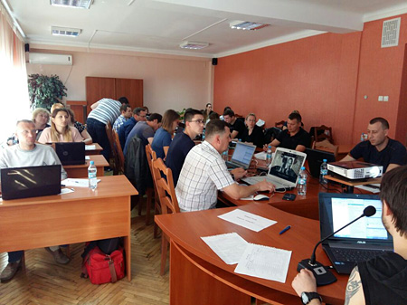
PHOTOMATERIALS SEMINAR |
||
|
|