
Innovative development of GIS 6 Agro for land bank management
Thorough management of any objects is a necessary and important process of their effective functioning. Land resources are no exception. Managing their availability, quality, functionality by insufficiently substantiated indicators and intuitive predictions leads to significant losses in agribusiness. The use of computer systems and technologies that provide farmers with a full range of information for the thorough development of management decisions helps to avoid negative consequences.
It is the use of geographic information systems that can provide key ways to solve technical, economic and organizational problems of business entities by rationalizing the time used and organizing a unified system for storing information about plots (fields) in the land bank.
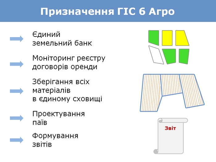
Based on the above, the issues of creating a unified land bank; monitoring the register of lease agreements; storing and connecting scanned and other materials in one storage; dividing land plots; and processing agricultural reporting are relevant. GIS 6 Agro, a network version of the program for managing an agricultural company's land bank, allows you to solve such issues.
This system is an example of the implementation of global innovative technological developments in Ukrainian practice. The program has several modules that include functionality for keeping records of land plots, crop rotations and fields, as well as the ability to monitor the validity of lease agreements and exchange information with other programs. Precise analytical tools allow you to quickly find the required plot, analyze the information, and print the necessary reports.
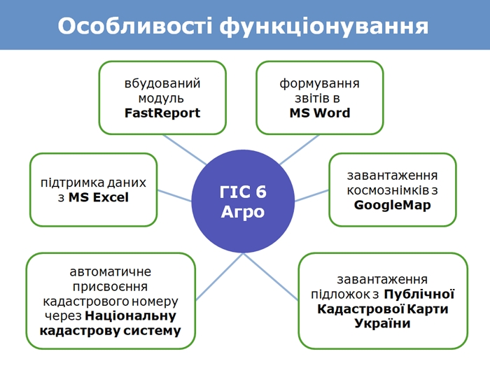
The functionality of GIS 6 Agro also includes:
- FastReport module built into the program for generating reports of any complexity;
- import/export of data from MS Excel files is possible;
- downloading satellite images from GoogleMap and other mapping servers;
- connecting coordinated shots;
- availability of tools for searching, selecting and screening data for further analysis of information;
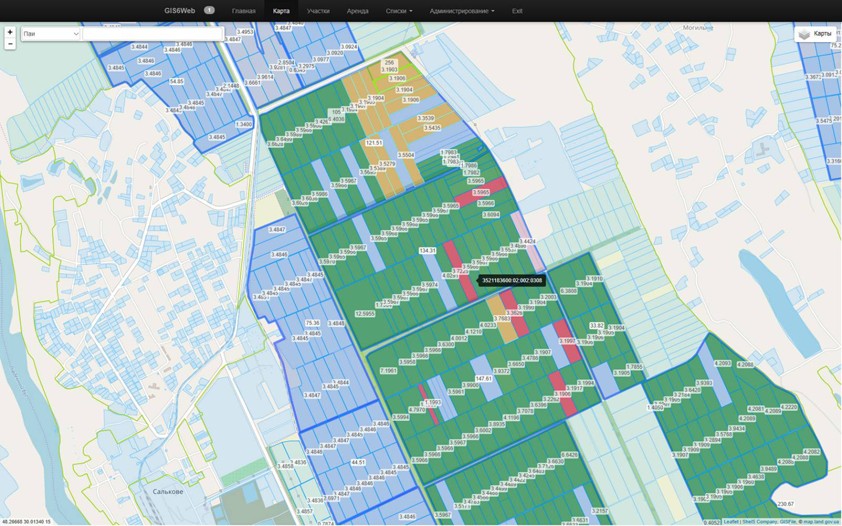
- display of the Public Cadastral Map of Ukraine, as well as search by cadastral number;
- the program has automatic calculation of distances, perimeter and area of land plots;
- assignment of a cadastral number according to the geometry of the site through the service of the National Cadastral System;
- storage of scanned and other materials in a single database;
- recording settlements with landlords.
ГІС 6 Агро містить можливості для реєстрації полів, земельних ділянок, договорів оренди та державних актів. The program has a built-in "Camera function..." module and a "Map" module. Support for importing and exporting to external sources helps to exchange land cadastral information files in In4 and Xml formats, retrieve objects from files in Dxf, Shp, In4, Xml, Kmz, Kml, Dmf, Mif, Txt, Dbf, Sdr, Wor, Art, In4, I15, Gbd, Cat extensions and connect Tif, Sid, Jpg, Gif, Bmp images.
To simplify the work, GIS 6 Agro has an auto-assignment of cadastral numbers to land plots through the NKS service and visualization of the display of objects by various parameters and conditions. New opportunities open up for the user with the connection of Internet maps from GoogleMap, the Public Cadastral Map of Ukraine and other similar programs, which stimulates the integration of GIS 6 Agro with external solutions. To automate the process and make it easier to navigate, the unified land bank has data search and filtering functionality, as well as automatic database backup.
Using an accurate cartographic approach allows for observations of the land cover and obtaining the necessary information for further analysis and processing. Only with the help of the developed system of cartograms can the necessary information be obtained and, by studying the data obtained, the state of land resources can be predicted. GIS 6 Agro allows you to maximize the use of the cartographic method of research, as well as the capabilities of geostatistics, which helps to quickly and accurately assess the situation regarding the state of the specified territory.
Thus, to summarize, GIS 6 Agro creates a new way of managing land resources, which allows you to regularly receive up-to-date and timely spatially coordinated information on the properties of land plots and mobilize all the necessary data in a single system as a basis for successful agribusiness management.