
 MAPDRAW 2 - VECTOR EDITOR AND SEARCH TOOL
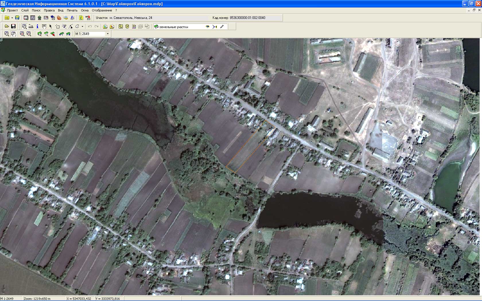
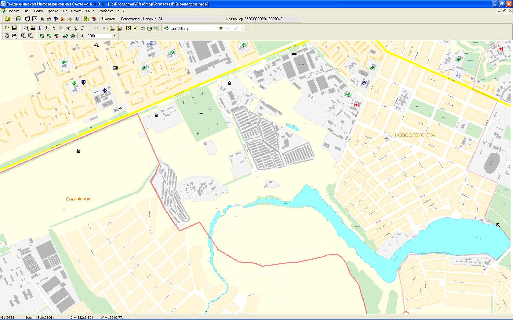
MapDraw 2 is the program that displays, creats, edits and searches for spatial information. The program allows you to display, create and сhange files in the internal and external formats Shp/Shx/Dbf of the program ArcGis/ArcView. There is the possibility of coordinating the raster in theBmp, Wmf, Jpg, Tif, and Sid format directly on the screen or in the window of coordination. It allows you to display an unlimited number of images and their size and there is also import and export of options binding from Tab, Rtr, Bpw, Jgw, Tfw, Sdwformats.. Group of raster files can be assembled in one or more layers. Except the outer layers: points, lines and polygons, there is also the inner cosmetic layer with the ability to create additional objects in it: text and symbols. The program contains powerful tools for search of one or more objects, and queries can be performed from external programs. Objects can contain both a set of fields with the attribute information and links to files in any format that can be displayed or changed directly from the program. Each layer has its own display of settings and search options. You can also export images in wmf, bmp, jpgformat from external programs.
Appointment
- coordinating of the raster information by any point (pixel - coordinate);
- manual and automatic digitization of raster information;
- processing of geodetic information;
- analysis of the origin, taking into account the heights;
- search tool for finding and analyzing of objects.
|
DISPLAY OF RASTER DISPLAY OF VECTOR VECTORIZATION OF |
COORDINATION OF SEARCH AND NAVIGATION TOOL GOOGLEMAP LAYER |


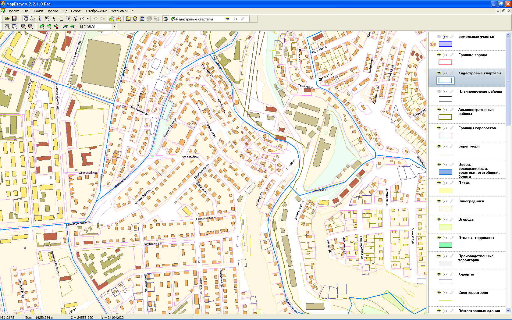

Features
- support of the format of the program Mapinfo (Tab) for the raster coordination;
- determination of the relative accuracy of coordination by axes in meters;
- support of the format of the program Invent-Grad (In4) for vector information;
- convenient work with objects as in CorelDraw;
- sticking to the nodal points, entering and deleting of points with double clicking;
- deleting of the previous points during the depiction;
- image shift with right mouse button in all modes;
- an arbitrary scale both with the mouse, function keys and manually;
- backoff of the scale changes and displacement;
- backoff of the objects changes;
- display of selected objects in the center and the entire screen;
- automatic calculation of distance, perimeter and area;
- automatic identification of the object (point, line, polygon);
- quick access to the coordinates of the object;
- automatic digitization both of lines and polygons;
- function of automatic adding of points before the beginning, in the middle and at the end of the list of
object coordinates
by pressing the Alt key and moving of the mouse cursor;
- rapid transformation into any available object type;
- the ability to display the names of the points;
- import from Pts (Prism, Ashtech Solution) and Wor
(MapInfo)formats;
- rotation and moving of the objects with the mouse;
- the ability to scale text and symbols;
- more than 20 types of lines;
- the creation of complex analytical and search programs on the basis of the technology.
Completion
- installation;
- user manual;
- settings for the updates;
- annual support of the program.
Comparison table
|
Features of the program |
Professional |
| Creating and editing of projects | Yes |
| Creating and editing of layers | Yes |
| Coordination of images | Yes |
| Data search | Yes |
| Coordinate transformation by the transfer key | Yes |
| Coordinate transformation from the system in the coordinate system | Yes |
| Support of satellite imagery in MrSid format MrSid | Yes |
| Import of data from the exchange file format In4 | Yes |
| Connection of the layer GoogleMap | Yes |
Price
| Version | Description | Price | |
|
MapDraw 2 Professional |
|||
| MapDraw 2 Professional Local | Local license for 1 workstation |
US$ 190 |
Buy |
| MapDraw 2 Professional Net 5 | Network license for 5 workstations |
US$ 670 |
Buy |
| MapDraw 2 Professional Net 10 | Network license for 10 workstations |
US$ 1150 |
Buy |
| MapDraw 2 Professional Net 20 | Network license for 20 workstations |
US$ 1910 |
Buy |
Other
![]() Download the demo version of MapDraw 2.2.4.1 Trial (55,42 Mb)
Download the demo version of MapDraw 2.2.4.1 Trial (55,42 Mb)
![]() Download the demo version of MapDraw 2.2.1.2 LT (26,34 Mb)
Download the demo version of MapDraw 2.2.1.2 LT (26,34 Mb)