SEMINAR-TRAINING GEODETIC INFORMATION SYSTEM 6
17-18 may 2018
venue of Kyiv, st. Lomonosova, 18, rm. 101
(Kyiv Cooperative Institute of Business and Law)
17-18 may 2018 representatives of 8 regions: Kyiv, Chernihiv, Zhytomyr, Kharkiv, Zaporizhzhya, Mykolaiv, Dnipropetrovsk and Odesa gathered for a two-day training seminar "Geodetic Information System 6", dedicated to formation of an exchange file of land cadastral information in the format XML, in accordance with Resolution No. 1115 dated December 23, 2015, Resolution of the Cabinet of Ministers No. 1051 of October 17, 2012 and the requirements of the National of the cadastral system (NCS) when forming the data of the XML exchange file, import and calculation of theodolite courses and pickets, creation of land plots, restrictions and servitudes, transformation of coordinate systems in USK-2000 and MSC-2000, connection to the Public cadastral map of Ukraine and Google Maps.
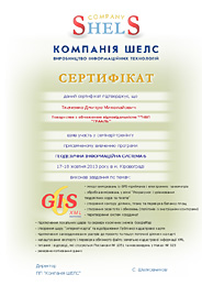
This is already the tenth seminar for project managers organizations, conducted by the SHELS Company. The main feature these events provide an opportunity to practice skills in practice on work in the GIS 6 program, get answers to questions of interest and share experiences with colleagues. The participants of the first day got acquainted with the possibilities of the GIS 6 program; general information about windows "Land plots" and "Camera functions"; created land sites; filled in data on subjects of law, restrictions, servitudes, lease and technical documentation; imported and exported exchange files in XML format. The second day was devoted to processing measurements in the window "Calculation and alignment of theodolite moves and pickets"; creation of adjacencies, servitudes; transfer of coordinates from SK-63 to USK-2000 or MSC-2000 and vice versa; work with layers; familiarization with the basics map module "MapDraw 2". According to the results of the training seminar each participant received a named Certificate.
ORGANIZATIONAL MATTERS
Date: 17-18 may 2018
Event venue: Ukraine, Kyiv, st. Lomonosova, 18, rm. 101 (Kyiv Cooperative Institute of Business and Law)
Terms: classes focus on hands-on learning work program GIS 6, therefore work more efficiently participants, it is desirable to take seminar-training notebook
The cost of participation:
At paid until 30.04.2018, one day of participation - 700 UAH for 1 person;
two days of participation - 1200 UAH for 1 person;
If you pay from May 01 to May 11, one day of participation - 900 UAH for 1 person; two days of participation - 1700 UAH for 1 person.
The price includes: participation in training seminar, training materials, CD with training materials and Certificate
SEMINAR SCHEDULE
| 17.05.2018 | 18.05.2018 |
|---|---|
| 09:00-10:00 - arrival participants, registration; | 10:00-18:00 - holding training workshop with a break; |
| 9:00-17:30 - holding training workshop with a break; | 17:30-18:00 - leaving participants. |
SEMINAR MATERIALS
PROGRAM SEMINAR
Day 1
1. Installing and updating the program GIS 6
2. Overview of the program GIS 6
3. General information about the "Land plots" window, working with labels and filters
4. Import measurements from GPS-receivers and total stations
5. Creating land plots
6. Complete data on the subjects of rights, restrictions, easements, rental
7. Understanding the "Cameral function", work with layers and tools
8. Viewing land plots on the map (mapping module MapDraw 2")
9. General information about the interchange file format XML
10. Import and export exchange files XML. Setting up the export and checking the filling of the plots before exporting
Day 2
1. The contour plot, plan and balance check areas
2. Analysis of the measurements in the "Calculation and adjustment and theodolite traverses pickets"
3. An inverse geodetic task or creation of a theodolite progress sheet without a real theodolite progress
4. Create subcontractors, customize the display picture
5. Creation of easements and restrictions (polygons with internal circuits)
6. Cuttings and pegs (loops) in contours or areas with third-party land uses
7. Discussion of the projection of USK-2000 and geodetic points
8. Translation of coordinates from SK-63 to USK-2000 or MSK-2000 and vice versa. Using GISFile.com to translate coordinates in USK-2000
9. Introduction to the basics of mapping module "MapDraw 2"
10. Connecting Local layers and server space images GoogleMap and Public cadastral map. Layer options, mapping
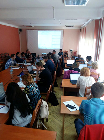
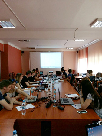
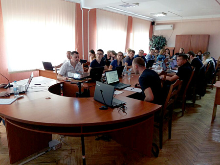
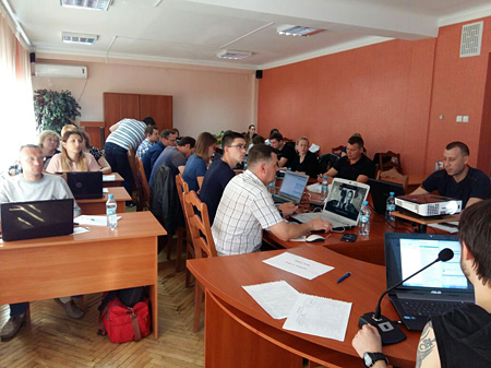
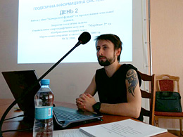
SEMINAR PHOTO MATERIALS