
Geodetic Information System 6

We present you the new version of Geodetic Information System 6 which is a logical continuation of previous versions. The latest version has much improved database structure with ability to work in local and multi-user mode. Microsoft SQL Server 2000 - 2012 is used as your SQL database server. Databases can be divided into registers: certificates, land, real estate, technical documentation, the state acts, leases, registration cards and registration books.
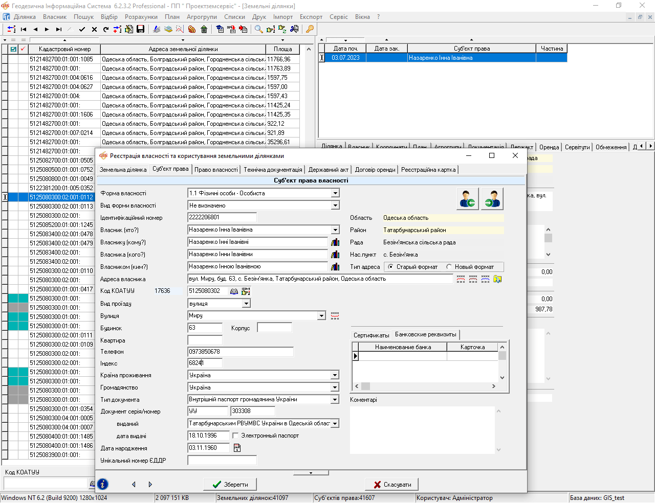
The structure of the database is organized so that while you creat land parcels and fill the options, automatic filling of registry is performed . Registries have separate windows in the program, and operative statistical information is carried out according to the public acts, books of registration and the registration cards.
As in the previous version the databases are divided into general-purpose databases that contain lists of classifications and working databases which contain the data entered by user.
In the new version easements, restrictions and rentals are formed in separate lists. We want to draw your attention that the lease can now be linked to several parcels of land and have a separate statement of origin.
The ideology of appearance, termination and transfer of the subjects right on the certificates, land parcels and real estate is incorporated in the program. Natural and legal people are now in separate registers, and the staff of the legal entity is associated with a list of individuals. Documents confirming of the right of ownership (use) are in a single database that is used when there is appearance or termination of the right of ownership, use, easements, restrictions, etc.
Geodetic Information System 6 contains all the previous versions and also has the ability to import all the data available in full from GIS 5.3.
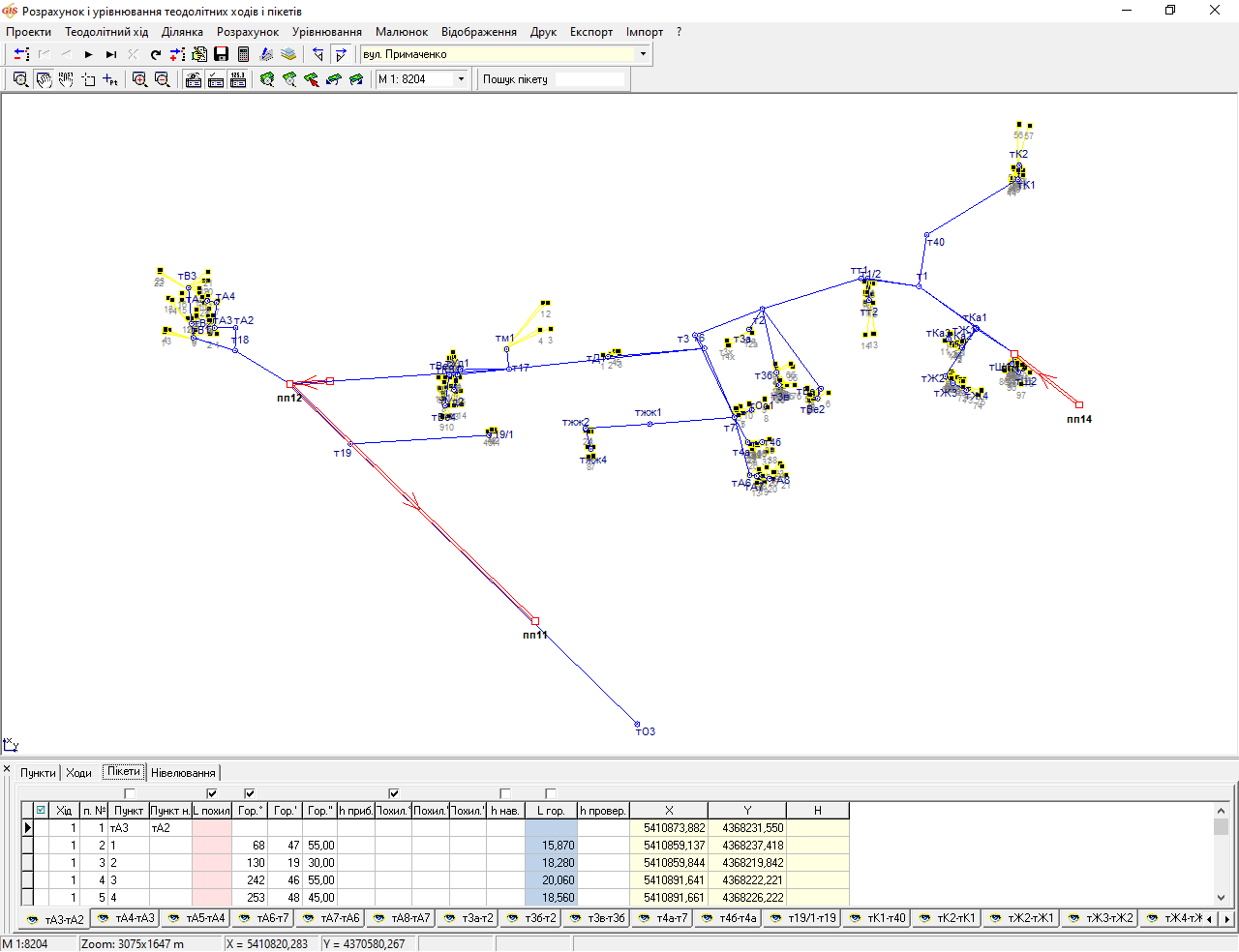
The administrator has the opportunity of access for individual users. The program has enough features to perform calculations and coordinate transformations, beginning from the calculation of theodolite lines and ending with the transformation of the coordinate system. Import and export of data are available in all common data formats. The program comes with a large set of ready-report forms among which there are the state acts, registration cards, cadastral plans, technical reports, etc. All reporting forms can be arbitrarily adjusted by users.
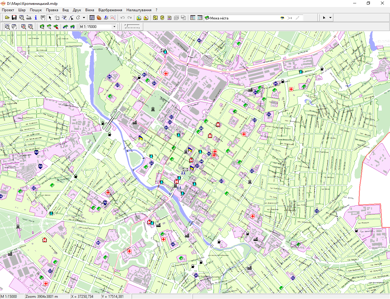
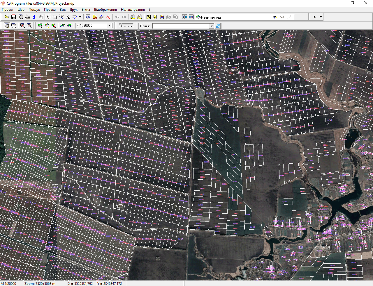
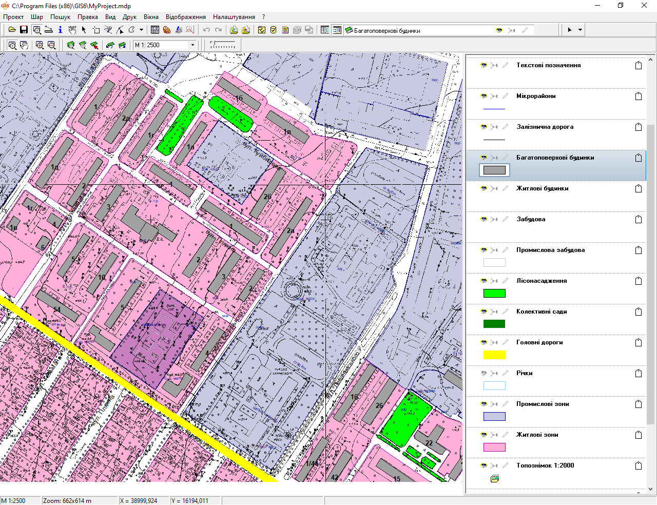
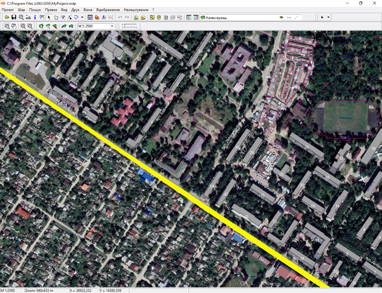
Separately, you can also highlight the presence of MapDraw module in the program , which provides the ability to connect and display the external raster and vector layers ArcView / ArcGis together with the internal layers: land parcels, cadastral units, the types of land parcel, soil characteristics, easements, restrictions, and leases. Displaying of the maps can be combined with the attribute information mapping. There is the possibility of positioning of the current plot, or a layer /object of the outer layer . The program can display and coordinate raster in the Bmp, Wmf, Jpg, Tif and Sidformat directly on the screen or in the coordination window. The program can display an unlimited number of images.There is also import and export of options of the binding from the Tab, Rtr, Bpw, Jgw, Tfw, Sdwformats. Map also includes powerful tools for finding and positioning on the found object.
The program Geodetic Information System 6 is a licensed software product and is recommended for use by the State Committee of Ukraine of land resource.
Geodetic Information System 6 is supplied both with a single-user and networked electronic USB keys for a given number of users. The standard delivery of program includes GIS 6 Professional and GIS 6 Client versions. The program also has its own graphical server GIS 6 MapDraw Server which allows to speed up the process of maps displaying , reduce LAN traffic as well as secure access to vector and raster data stored on the server.
Are you still using multiple software products?
Do you need to combine all available data in one database and work in a network mode with several users?
Do you need to delineate the rights of access for different users and be able to analyze the data quickly?
All this and much more the program Geodetic Information System 6 allows you. Land management companies, departments and offices of the State Committee of Ukraine of Land Resources, as well as branches of the State Land Cadastre Center have successfully used the program Geodetic Information System 6. With our product the upgrade of planning and cartographic materials in all areas of Odessa region is done, electronic circuits of land administrative districts in the territory cut of rural, suburban, urban; councils are designed, duty cadastral plans of most cities and districts of Odessa region are carring out. We help our clients to do the installation of the program, to convert existing data and carry out professional support!
SINGLE DATABASE OBJECT AND ENTITIES
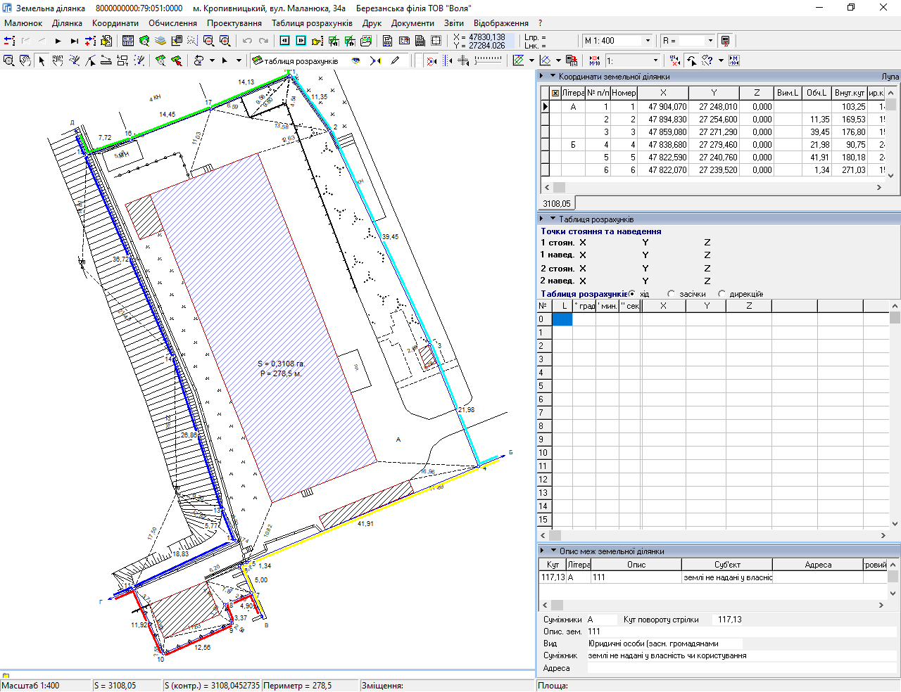
CREATION OF DUTY LAND PLANS
CALCULATING AND BALANCING OF THEODOLITE LINE
LAYER GOOGLEMAP FOR THE CHOSEN COORDINATE SYSTEM
MAPPING OF INTERNAL AND EXTERNAL LAYERS
CREATION OF TOPOGRAPHIC PLANS
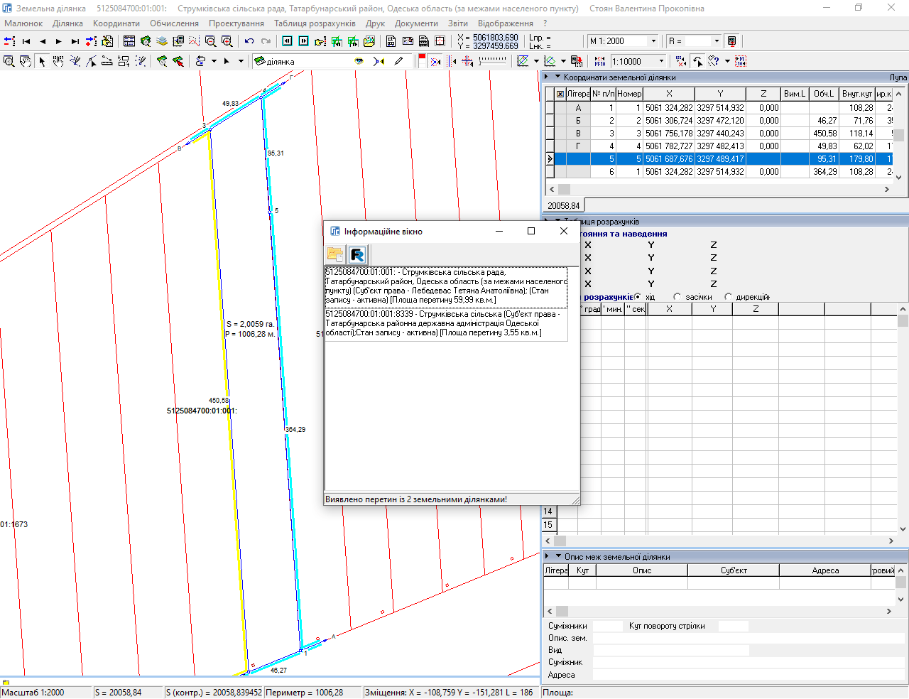
TOPOLOGY CHECKING AND PROVISION OF CADASTRAL NUMBERS
CHECKING THE COMPLETENESS BEFORE GENERATING THE XML FILE

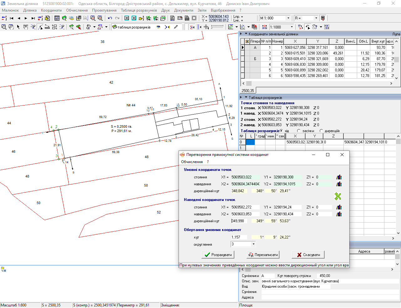
CAMERAL STUDIES DATA, PROJECTION, COORDINATE TRANSFORMATIONS
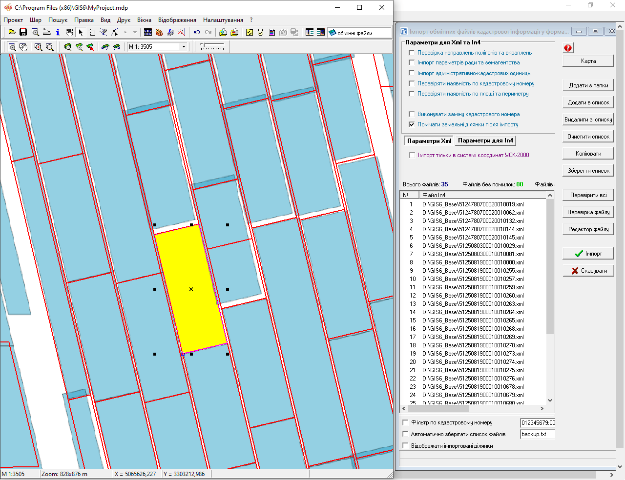
IMPORT/EXPORT OF EXCHANGE FILE IN IN4/XML
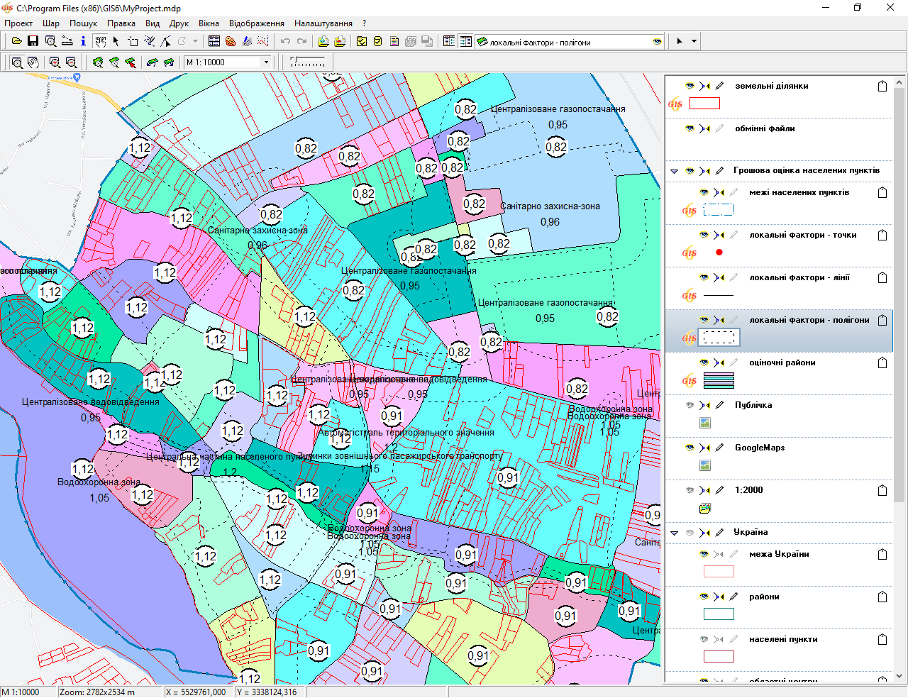
FISCAL REGULATORY ASSESSMENT SETTLEMENTS AND LAND PARCELS
LAYER GOOGLEMAP FOR THE LOCAL COORDINATE SYSTEM
COMPARATIVE TABLE OF VERSIONS OF THE PROGRAM
Versions of GIS 6 program: Standard, Professional, SLC and the Client. Professional and Client. Versions Professional and Client are available while purchasing of Geodetic Information System 6. The user can choose the appropriate version for him. The main difference between versions is a set of features and performance.
| Features of the program Geodetic Information System 6 | Goskomzem | Professional | Client |
|---|---|---|---|
| Of land parcels register | |||
| Register of the real estate | |||
| Register of technical documentation | |||
| Register of public acts | |||
| Register of lease agreements | |||
| Register registration books | |||
| Register registration cards | |||
| Register of land books | |||
| Register of arrests | |||
| Adaptation of the program under resolution number 1021 | |||
| Window "Calculation of the theodolite and leveling lines" | |||
| Window "Cameral functions..." | |||
| Window "The monetary valuation" | |||
| Window "Map" | |||
| Import and export of exchange files of land and inventory information In4 and Xml | |||
| Administrative access | |||
| Adapting programs to databases of more than 500 thousand plots | |||
| The simplified interface and features | |||
| The calculation of regulatory pecuniary valuation of land settlements | |||
| The calculation of regulatory pecuniary valuation of land | |||
| Print the state acts | |||
| Print registration cards | |||
| Print the registration books | |||
| Print the book landed | |||
| Print cadastral plans | |||
| Print the technical documentation |
Сompletion
- installation CD-disk
- electronic USB key
- settings for the updates
- annual support program